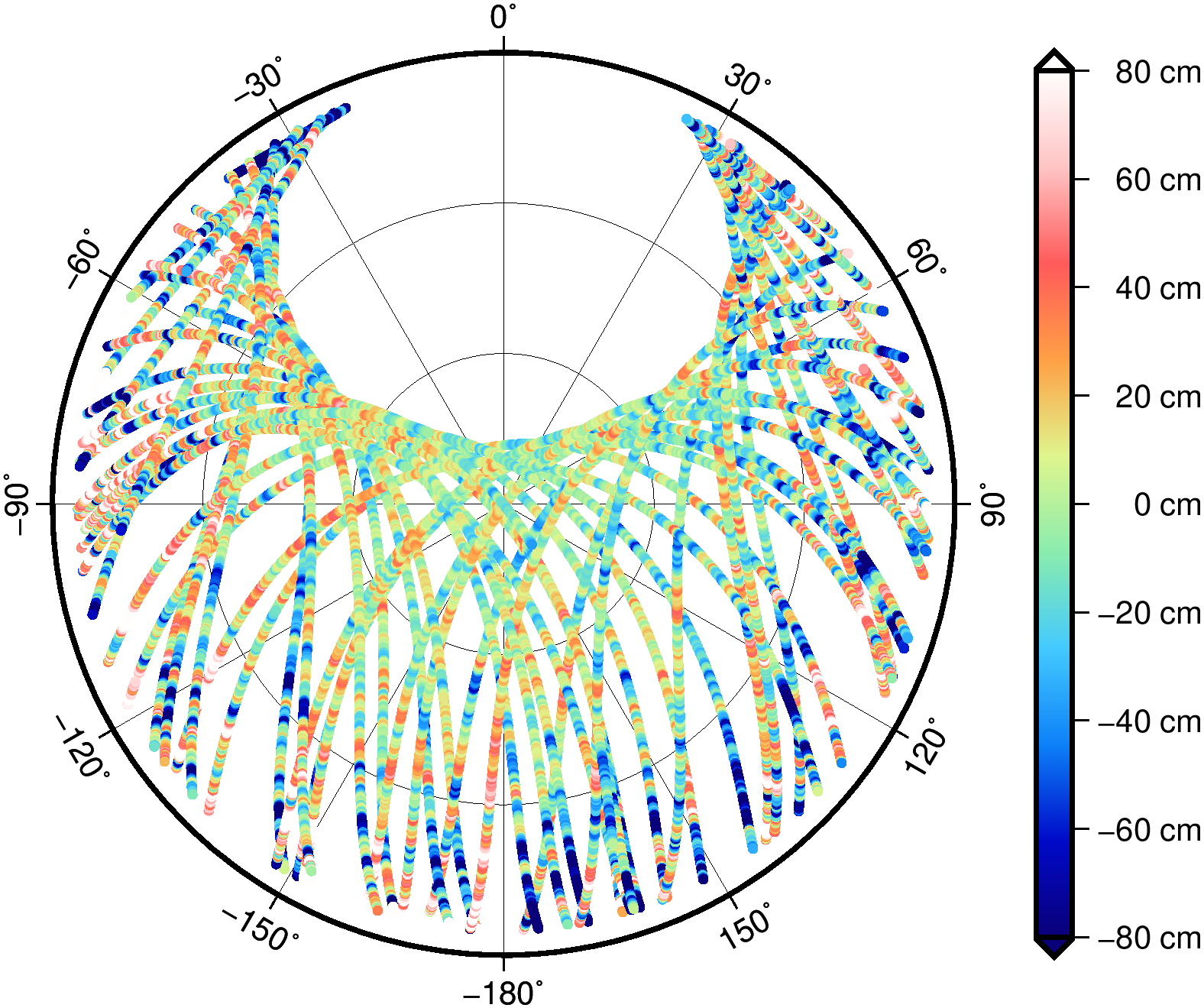
GnssResiduals2Skyplot
Write GNSS residuals together with azimuth and elevation to be plotted with PlotMap.
Azimuth and elevation are written as ellipsoidal longitude and latitude in a griddedData file.
The choosen ellipsoid parameters R and inverseFlattening are arbitrary but should be the same
as in PlotMap. If with typeTransmitter (e.g. '***G18')
a single transmitter is selected the azimuth and elevation are computed from the transmitter point of view.
For each GNSS type an extra data column is created.
A GNSS residual file includes additional information besides the residuals, which can also be selected with type
A1*,E1*: azimuth and elevation at receiver-
A2*,E2*: azimuth and elevation at transmitter -
I**: Estimated slant total electron content (STEC)
Furthermore these files may include for each residual type information about the redundancy and the accuracy relation $\sigma/\sigma_0$ of the estimated $\sigma$ versus the apriori $\sigma_0$ from the least squares adjustment. The 3 values (residuals, redundancy, $\sigma/\sigma_0$) are coded with the same type. To get access to all values the corresponding type must be repeated in type.
| Name | Type | Annotation |
|---|---|---|
outputfileGriddedData | filename | |
type | gnssType | |
typeTransmitter | gnssType | choose transmitter view, e.g. '***G18' |
inputfileResiduals | filename | GNSS receiver residuals |
R | double | reference radius for ellipsoidal coordinates |
inverseFlattening | double | reference flattening for ellipsoidal coordinates |